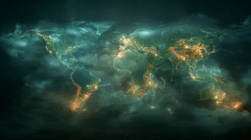
Glowing Lines and Outlines of the Map of America

The image features a map of America displayed using high-quality graphics. The outlines of countries and major cities are highlighted with bright orange and yellow lines, creating a reflective glow effect. The dark background of the map makes the glowing points more noticeable and gives the image a futuristic look. The borders between states are clearly marked, and major cities such as New York, Los Angeles, and Toronto are illuminated, creating the illusion of vibrant movement and life. The use of geometric lines and grids adds a scientific aesthetic and a constructive approach to the image. This style of graphics can be used for data visualization, cartographic representations, and educational purposes.
This image can be useful for illustrating topics related to geography, globalization, technology development, and population. It can be used in presentations, scientific articles, websites related to geography, ecosystems, as well as in educational materials for students. Additionally, cartography that displays data in this way can be used in business analysis to demonstrate markets, logistics routes, and environmental changes. This image can attract the audience's attention due to its modern and vibrant design, making it easier to grasp complex concepts and information.


